
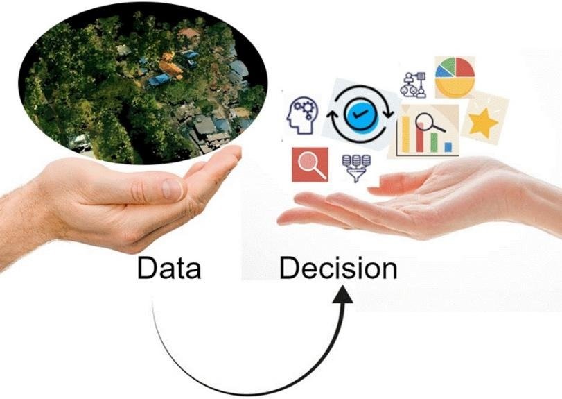
Across the globe, the natural and man-made infrastructure systems are becoming more interconnected and complex, leading to a greater need for analysis-ready spatial data for governance, planning, monitoring changes, or making informed decisions. In this context, having accurate data is not sufficient. What truly matters is the ability to interpret data quickly and effectively for empirical decision-making. Three-dimensional mapping with technologies such as LiDAR (Light Detection and Ranging) provides depth and thus structure, enabling accurate representations of cities, landscapes, and infrastructure. Using LiDAR, the 3D data is generated as a collection of millions or even billions of spatial points, that collectively represent a region. While point clouds are rich in geometric detail but they lack meaning. Together, they represent positions and shapes, but direct extraction of information or utilitarian queries from point clouds was limited by the lack of meaning associated with each point and their large volume. This gap between the available or acquired point cloud data and their meaningful interpretation restricts their practical use. To address this challenge, we developed Geosemantic Point Cloud Enrichment (GPCE), a framework that transforms classified point cloud data into intelligent, analysis- and application-ready data.
GPCE morphologically transforms point clouds by adding a layer of intelligence. It enables us to understand not just where something is in the large point cloud datasets, but also what it is and how it relates to its surroundings. Instead of treating points as isolated units, GPCE groups them into meaningful entities, such as a set of points that represent a building, a group of trees, a section of a power line, etc., and enriches them with both geospatial and contextual information. This results in query output that serves both as information for empirical decision-making and as point clouds for perceiving a real scenario. For example, with GPCE, users can:
• Identify individual objects in a dataset
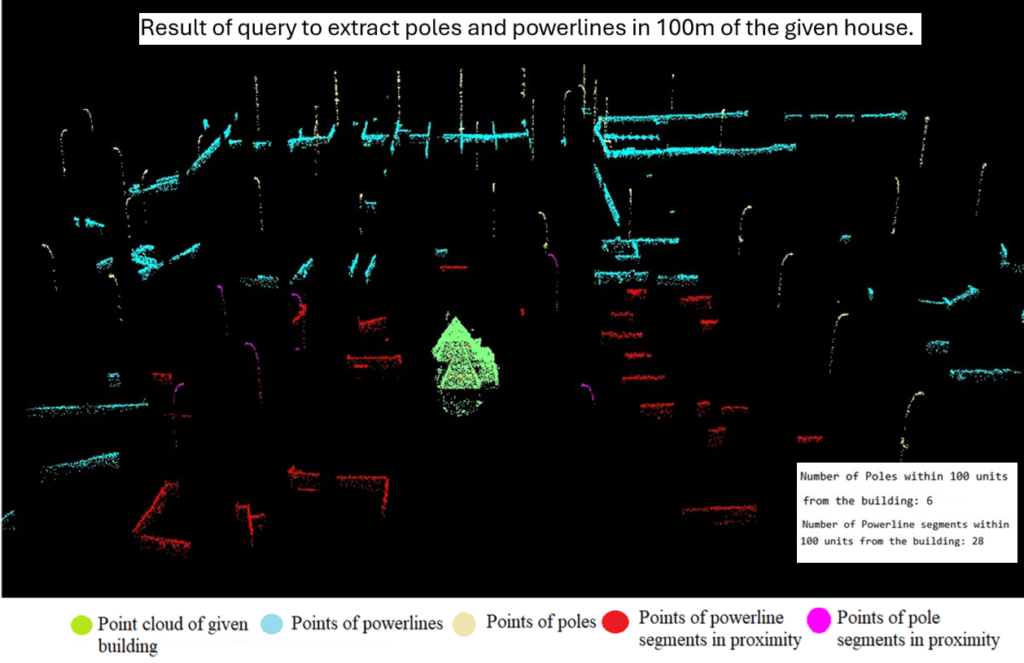
• Query specific features of the object, such as buildings above a certain height
• Track spatial and temporal changes in an area • Integrate point clouds with socio-economic and Geographic Information Systems (GIS) data.
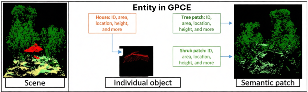
GPCE introduces structure, meaning, and context to an otherwise abstract dataset. This transforms point clouds into an analysis and application-ready dataset. The GPCE framework is a bimodular architecture encompassing Entity Point Cloud Storage (EPS) and the Entity Data Model (EDM). EPS stores enriched point-level data, while EDM manages entity-level details and relationships. These modules are connected using an ontological structure that links each point to an entity in space. An entity could be an individual object or a semantic patch of objects.
The GPCE framework accommodates variations in point density, ensures consistent representation of diverse entities in the dataset, and supports dynamic updates. This allows the data to remain relevant, and with the new data, changes can be monitored and updated. GPCE shifts the point clouds from geometric representation to an entity-based geosemantic framework for empirical decision making and introduces a new paradigm for direct utility of point clouds in various applications. It enables multi-dimensional data analysis by combining spatial and non-spatial information with point clouds. Overall, GPCE enriches the point clouds to extract information and relevant point clouds for applications, including urban planning, infrastructure management, environmental monitoring, and disaster response, that require timely and accurate insights.


